Dem
Advertisement


Shoot 'dem Ducks Free v.1.1.0.0
Take aim and fire! Collect your trophies and shoot 'dem ducks. How many rounds can you go? 5? 10? 50? 100? See if you can get all 6 trophies. More will be added in the future. This version is the same as the paid version, but ad-based. Comments and
Advertisement

Shoot 'dem Ducks v.1.1.0.0
Take aim and fire! Collect your trophies and shoot 'dem ducks. How many rounds can you go? 5? 10? 50? 100? See if you can get all 6 trophies. More will be added in the future. Comments and suggestions are welcome. v1.1 includes a few bug fixes and
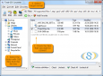
SimpleDEMViewer v.3.2.1
SimpleDEMViewer browses DEM (Digital Elevation Model) data as pictures.
Total GIS Converter v.1.5
Total GIS Converter is a powerful converter of GIS files. It converts AEP, GRD, ADF, E00, FLT, APR, SHP, DXF and many other GIS formats to TIFF, PNG, JPEG, BMP. Along with conversion it can scale and resize your files. Download your free copy now!
JoeQuake v.0.14
JoeQuake is made by Jozsef Szalontai JoeQuake is an improved NQ engine with plenty of ZQuake and FuhQuake graphical effects included. JoeQuake's main aim is to provide pleasant demo watching for .dem files.
Scenery Designer Toolkit v.1.0.1
Use this special toolkit to create or modify exciting sailing areas for Sail Simulator 4.2 (or higher). The setup of the toolkit installs the following programs: * DEM builder 1.2 to create DEM's in *.
AutoDEM
AutoDEM (aka as AutoMNT) is a freeware GIS software to create Digital Elevation Models (DEM) from scanned topographic maps for Windows. Through different data layers (map, contours, DEM, etc.
00100110 by DTgrafic v.1.0
Computer sind dumm! Sie verstehen immer nur 0 und 1, egal welche Daten sie verarbeiten, oder ob Text oder Bilder auf dem Bildschirm anzeigt wird.
Coltop3D Beta v.1 6
Coltop3D is a full featured LIDAR data processing and analyzing software for geologists. It is designed for the interactive analysis of orientation of airborne and terrestrial LiDAR data and digital elevation models (DEM) at local and regional scale.
IMSware.Dashboard v.2012.0.21.3b
Das IMSware.Dashboard schafft eine zentrale, systemunabhängige Visualisierung großer Datenmengen und bereitet sie in verdichteter Form auf. Datenquelle u.a. Oracle, SQL-Server, Excel etc. Das Programm ist direkt nach dem Entpacken lauffähig.
RadioLink v.6.041
Radio Planning Software by Orbit Design using USGS DEM, SDTS DEM, SRTM3, SRTM30, GTOPO30 and Ordnance Survey Landform Profile, Panorama and Panorama Plus map data. Up to 25 radio links can be analised in one project.